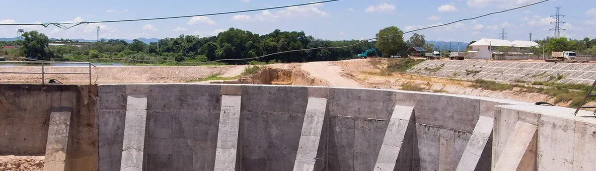
Seattle’s geology shifts dramatically within just a few city blocks. A crew digging in Pioneer Square encounters the fill and estuarine muds of the old tideflats, while a project up in Capitol Hill hits the hard, overconsolidated Vashon glacial till that gives contractors fits with boulders and dense silt. These two excavation environments require fundamentally different monitoring approaches, and the wrong instrumentation plan leads to delays that nobody wants to explain to the owner. Our geotechnical excavation monitoring program bridges that gap, pairing the right sensors with a reading frequency that matches the ground response. When the till relaxes slowly over weeks, we track it differently than the rapid pore pressure shifts in the fill, and we have seen enough Seattle basements to know when a 0.25-inch movement is just bedding-in versus when it signals trouble behind the shoring. For deeper cuts near the Ship Canal, where groundwater rises and falls with the locks, we often coordinate our monitoring with deep excavation instrumentation to catch the interaction between dewatering drawdown and wall deflection before it shows up in the street above.
In Seattle's glacial till, the first 48 hours of unsupported cut behavior tell you more than a month of weekly readings after the fact.
Local ground factors
Between 1910 and 1920, the Denny Regrade reshaped central Seattle, sluicing entire hills into the bay and creating a patchwork of engineered fill that now underlies much of Belltown and South Lake Union. That legacy means a modern excavation can transition from natural Pleistocene deposits to uncontrolled hydraulic fill within a single lot, and the monitoring system has to catch the differential settlement that results. The 2001 Nisqually earthquake reminded everyone that these loose fills are prone to cyclic mobility, not just static settlement, and excavation monitoring in these zones must account for the drained-undrained transition during long-duration dewatering. We instrument the ground surface and the shoring separately, because the fill often settles faster than the wall deflects, creating a void that compromises the tieback load. Our crew places the survey targets with enough redundancy that a single lost prism does not create a data gap, and we benchmark all readings to a deep rod monument driven into the glacial till rather than relying on a curb line that might itself be moving.
Frequently asked questions
What does geotechnical excavation monitoring typically cost for a Seattle project?
A complete monitoring program for a typical mid-rise excavation in Seattle, including pre-construction surveys, inclinometer installation, settlement markers, and six to twelve months of readings with reporting, generally falls between US$790 and US$2,490. The range depends on the number of structures in the zone of influence, the depth of the cut, and whether automated instrumentation is required. We provide a fixed-price proposal after a site walk and review of the shoring drawings so there are no surprises once the readings begin.
When is excavation monitoring required under the Seattle Building Code?
Seattle's IBC amendments (Chapter 33) and SDCI requirements trigger monitoring for any excavation deeper than 12 feet, or any excavation that extends below the bearing elevation of an adjacent foundation within a horizontal distance equal to the depth of the cut. Monitoring is also mandated when dewatering could affect neighboring properties, when vibration from rock-breaking exceeds ambient levels, or when the project falls within a mapped liquefaction-prone zone. Our team reviews the geotechnical baseline report and the shoring design to determine the specific instrumentation that satisfies the building official's conditions of approval.
How do you distinguish between normal settlement and a developing failure in Seattle's glacial till?
Glacial till in Seattle typically exhibits a rapid initial relaxation of a few hundredths of an inch during the first 48 hours after a lift, followed by a flattening curve that asymptotes within a week. We flag any acceleration in the rate of movement after that initial bedding-in period, particularly if it correlates with rainfall or dewatering changes. In the Vashon till, a loss of negative pore pressure after a storm can trigger block failures that show up first as an uptick in the crack-gauge readings at the surface before the inclinometer sees the deep movement. Our trigger-action-response plan separates the routine signal from the precursor pattern, and we notify the contractor's superintendent directly when a reading crosses the yellow threshold so that the shoring can be reinforced before the condition reaches the red alarm level.